Route Check: Donner Summit
Route Check: Donner Summit
If you’re looking to add a little spice to your riding recipe in the Truckee area, look no further than Donner Summit.
Known to many local cyclists as the Bread & Butter ride, this classic route may be one of California’s most sought after King of the Mountain routes showcasing posted times from several notable cyclists and Tahoe residents like Andrew Talansky, Levi Leipheimer, Laurens Ten Dam, Katerina Nash and many more.
This route is a go-to fitness benchmark that you can return to year-after-year to test your mettle, your oxygen uptake, or just to earn an extra cold beer back at the shop.

Velo History on Donner Summit
The unofficial King of the Mountain (KOM) to some wheelmen historians might claim that Greg Lemond rode up it out of the saddle and in a massive chainring to post a sub 13-minute time from gate to gate. This was before Strava published the statement “If it’s not on Strava, it didn’t happen”. To that point, the lady claiming the Strava QOM (Queen of the Mountain) is currently a Tahoe resident named Clare Walton who tapped out a solid 18:12 summit. The KOM is currently held by Pacos patron Andrew Talansky who peaked out in a time of 13:06.
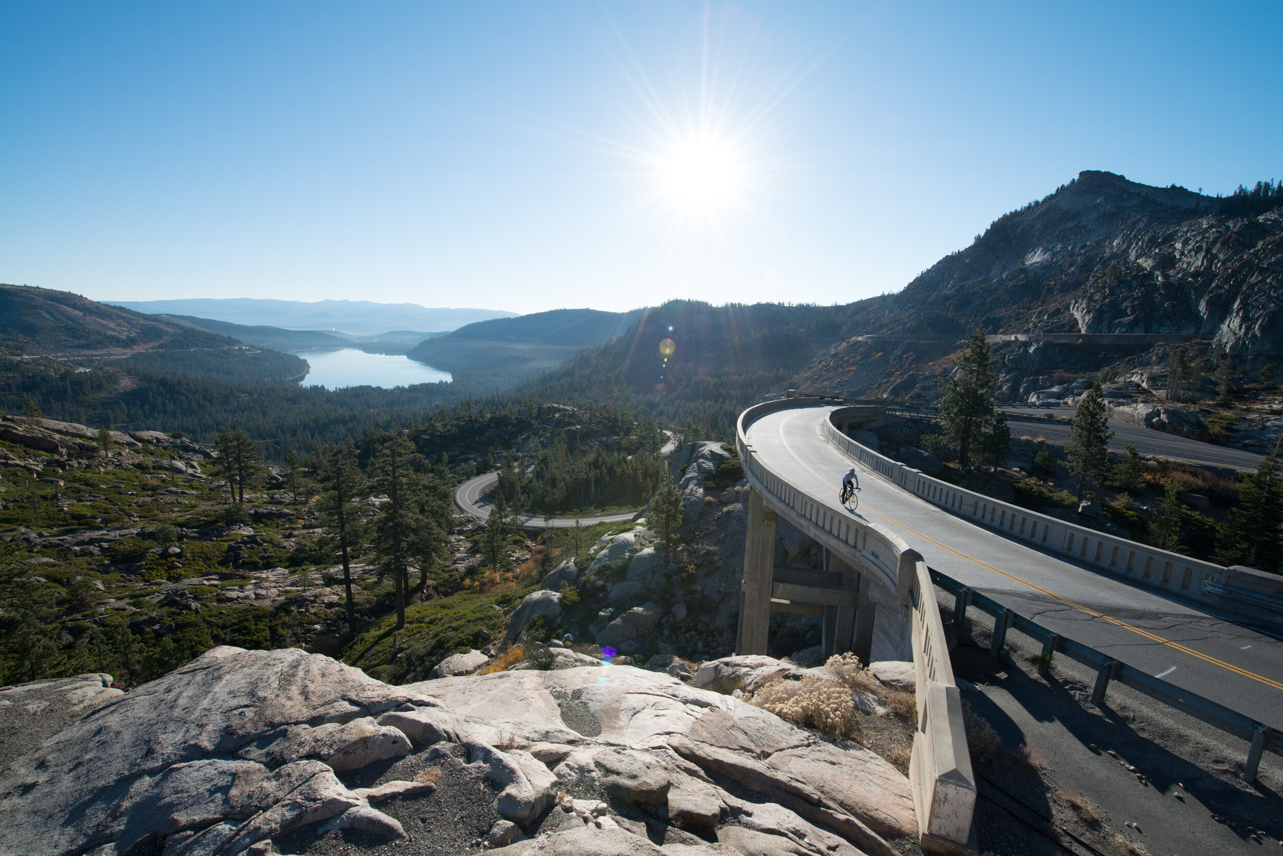
Many options make for an epic adventure. From the shop it's about a 15 mile ride, riding around the Serene Lakes neighborhood becomes 20-25 miles and heading to the end of Old Highway 40 at Cisco Grove and back, it's approximately 45 miles long. You have options to make your epic adventure.
Distance
Climb: 3.18 Miles Ascent | Elevation gain: 1,155 Feet | 7% Grade
Ride Route Options Vary: From the shop it’s about a 15 mile ride, if you head around the Serene Lakes neighborhood it quickly becomes 20-25 miles and if you head out to the end of Old Highway 40 at Cisco Grove and then return back, it’s approximately 45 miles long.
Route Summary:
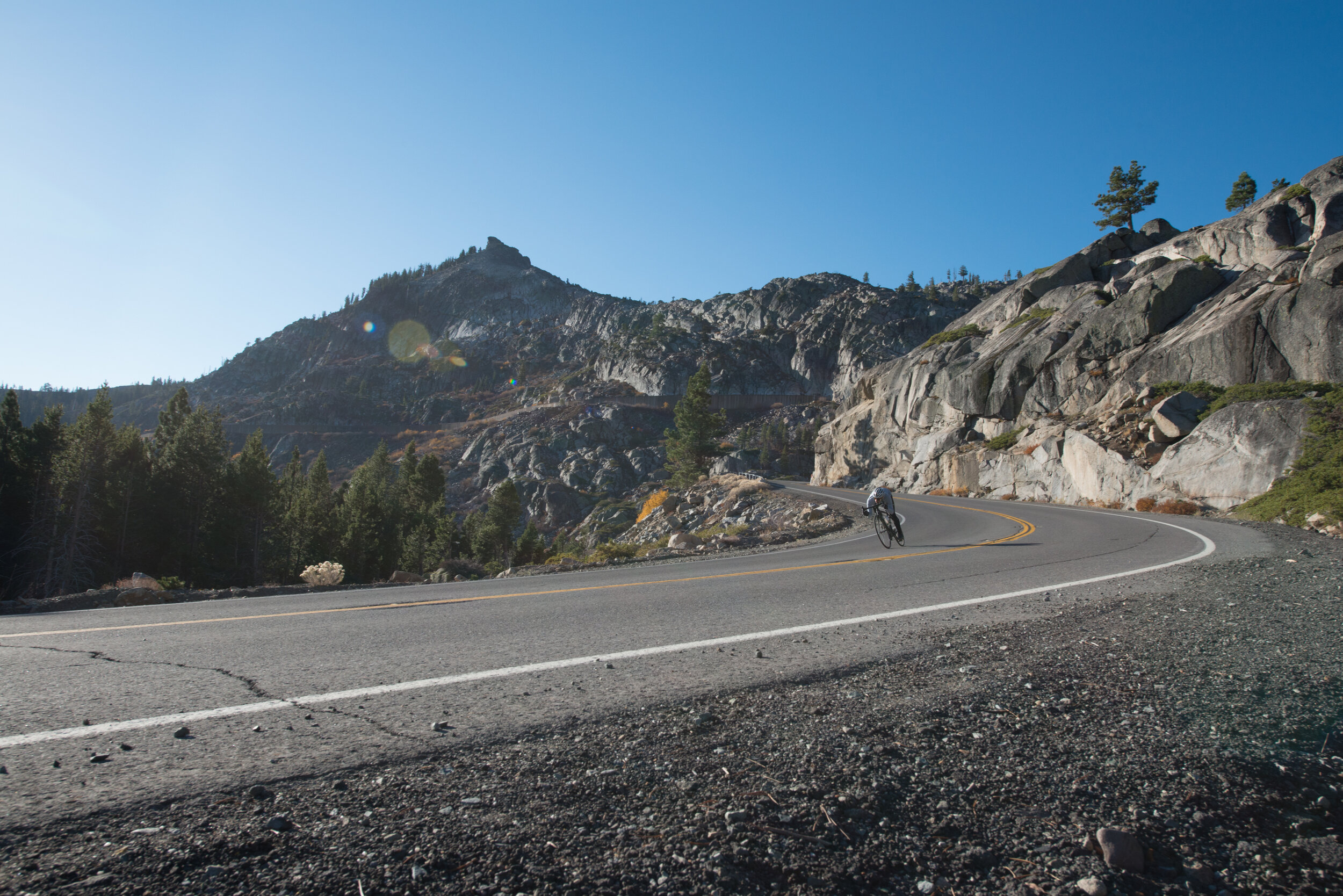
The route is paved. Some sections are rougher than others.
Begin your ride from the shop and to the top of Donner summit will be about 15 miles out and back. You can also add on a little more by looping into Serene Lakes community. The last option is to take it even further by heading out west on Old Highway 40 to Cisco Grove and return back to Truckee at the Cisco Grove campground for 45 plus miles of fun.
Description: (in three variations)
Ⅰ
➾ Park at Pacos and head West on Old Highway 40/Donner Pass Road towards Donner Lake
Cruise past Donner Lake towards West End Beach
At West End Beach head up the face of Donner Summit
Continue to ascend all the way to the top snow gate
Ⅱ
➾ You can turn back at the top of the climb or continue to Serene Lakes or Cisco Grove.
To ride through Serene Lakes, descend passed Donner Ski Ranch, climb up to the Sugar Bowl Gondola Entrance and then continue down Highway 40.
Make a left turn at the flashing red light at Soda Springs Road and continue to zigzag through the Serene Lakes community.
Right onto Pahatsi Road
Left onto Hillside Drive
Left onto Kilbourne Drive
Right onto Serene Road
Left onto Soda Springs Road and either return to Truckee...
Ⅲ
➾ Or turn left at Old Highway 40 to continue to Cisco Grove
You can ride this section as an out and back all the way to Cisco Grove along Old Highway 40

◎ Three Ride Options ◎
Ⅰ
Donner Summit out and back from Pacos:
approximately 15 miles.
Ⅱ
Serene Lakes add on loop from Pacos:
approximately 25 miles.
➾ Click for details
Ⅲ
Cisco Grove out-and-back from Pacos:
approximately 40 miles.